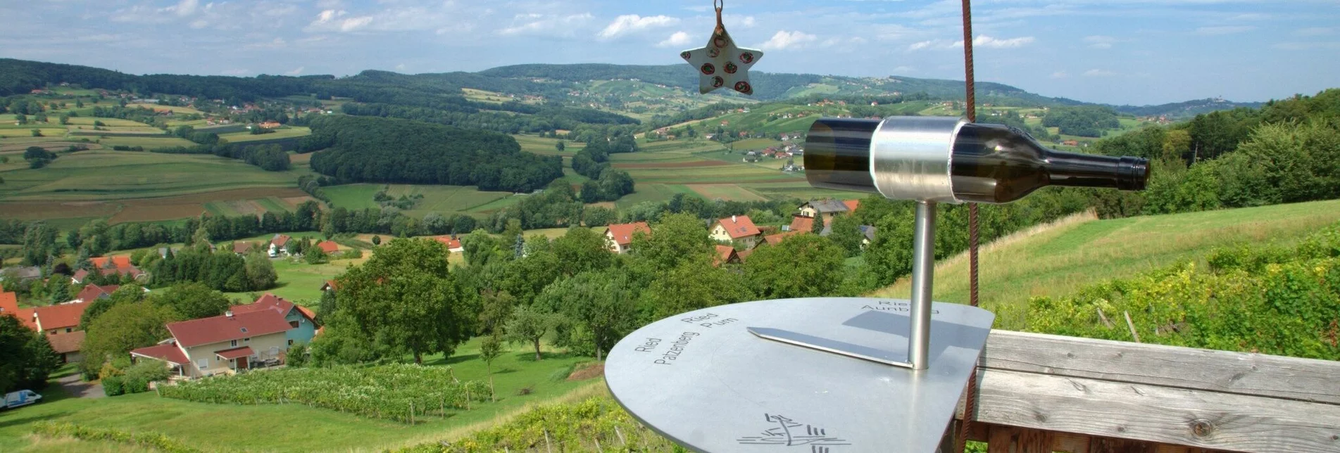
Hiking route The canticle of the sun path (Sonnengesangsweg) - Touren-Impression #1 | © Unbekannt Hiking route The canticle of the sun path (Sonnengesangsweg) - Touren-Impression #1 | © Unbekannt

The canticle of the sun path (Sonnengesangsweg)

Open
A circular trail with nature encounters at the foot of the King's Mountain on forest and meadow paths with eight designed stations on the Canticle of the Sun, the prayer of Francis of Assisi.
The Canticle of the Sun path is dedicated to the prayer of the same name by St. Francis of Assisi. The 9 meter high rusty statue of St. Francis with the wolf, created in 2006 by the Bolivian Fernando Crespo, cannot be overlooked. Artists from Tieschen have designed stations for the individual stanzas of the Canticle of the Sun, which encourage reflection and invite deeper encounters with the elements. In the church itself, the painting of St. Francis with Our Lady, painted by Rotky, is particularly noteworthy. 

Worth seeing:   

  • St. Francis and Tieschen Parish Church   
  • Statue of St. Francis with the wolf   
  • Beautiful view with moon and stars   
  • The wind harp   
  • Be praised by brother wind - information board   
  • Short branch to the basalt fissure   
  • Elisabeth spring as sister water   
  • Brother Fire

Characteristics

Skill
Fitness

Best season

January
February
November
December

The tour in numbers

easy
Level of difficulty
4,7 km
Route
1:30 h
Time
150 hm
Uphill
145 hm
Downhill
356 m
Highest point

Map & downloads

More information

Detailed information on how to get there can be found here.

Der Weg beginnt am Marktplatz und führt bei der Sonnenuhr vorbei, von wo aus es Richtung Basaltspalte geht. Zu Beginn sind 80 Höhenmeter Anstieg. Die Straße hinauf, dann am kleinen Wäldchen entlang aus dem Ort heraus in den Weinberg kommen wir zum Wald, wo sich der Zugang zu „Mond & Sterne“ befindet. Auf einer kleinen Aussichtsplattform hat man einen herrlichen Blick über Tieschen bis zum Bacherngebirge. Den Weg zurück bis zur Abzweigung und dann links weiter kommen wir zur Abzweigung zur Windharfe. Wir folgen noch ein Stück dem Waldrand und gehen dann in den offenen Wald hinein zur Basaltspalte. Darunter vorbei gelangen wir auf dem ebenen Waldweg auf einen Forstweg, unter dem ein wenig weiter rechts die Elisabethquelle aus dem Basaltstein sprudelt. Von hier gehen wir zum unterhalb liegenden Forstweg hinab, der uns linkerhand wieder aus dem Wald herausführt, geradewegs zum „Feuer“, das in einer Streuobstwiese neben dem Weg brennt. Sobald wir einen Hof erreichen, zweigen wir links ab und kommen im Wald rechterhand zum Labyrinth, das uns zur Erde führt. Danach auf dem Weg kurz rechts hinunter Richtung Pichla (wo es die Möglichkeit gibt, ca. 150 m nach rechts die Kapelle in Pichla zu besuchen), dann links entlang der Straße leicht bergauf und bald wieder rechts auf einem Feldweg wird schließlich Friede und Versöhnung thematisiert. Etwas weiter vorne auf der Straße dann rechts und noch einmal rechts geradeaus in den Ort hinab und links zur Kirche zurück kommen wir zur achten und letzten Station neben der Kirche: dem Tod, der als Tor zum Leben dargestellt wird.

Für die Wanderung genügend Zeit einplanen, Zeit um bei den Stationen inne zu halten. 

Timetables and travel information can be found directly at: Austrian Federal Railways (ÖBB), Steiermärkische Landesbahnen (STLB), www.busbahnbim.at.

With the BusBahnBim app from Verbundlinie, timetable information has never been easier: all bus, train and streetcar connections in Austria can be queried by entering locations and/or addresses, stops or important points. The app is available as a free app for smartphones (Android, iOS) - on Google Play and in the App Store.

Free Parking lots next to the main square available

Tourismusverband Thermen- & VulkanlandGästeinfo Bad RadkersburgHauptplatz 148490 Bad RadkersburgTel. +43 3382 55 100-90badradkersburg@thermen-vulkanland.atwww.thermen-vulkanland.at

Tourismusverband Thermen- & VulkanlandGästeinfo Bad RadkersburgHauptplatz 148490 Bad RadkersburgTel: +43 3382 55 100-90badradkersburg@thermen-vulkanland.atwww.thermen-vulkanland.at 

Gallery

What the weather will be like

Tieschen (260m)

Morning
very sunny
13°C
0%
5 km/h
Noon
sunny
23°C
5%
15 km/h
Night
sunny
19°C
0%
15 km/h
The day starts sunny, but will be partly cloudy in the afternoon.
Morning
slightly cloudy
15°C
15%
5 km/h
Noon
cloudy
19°C
40%
5 km/h
Night
cloudy
15°C
75%
5 km/h
Starting fair, then increasing cloudiness and possibly showers towards evening.
07.05.2024
cloudy
12°C 20°C
08.05.2024
slightly cloudy
10°C 18°C
09.05.2024
very sunny
9°C 21°C

Nearby accommodation options

Continue to search

You may also be interested in

Recommended tours

Accessible by public transport
Greißlerei De Merin | Greißlerei De Merin | © Erlebnisregion Thermen- & Vulkanland
Straden challenging Open
Route 26,6 km
Duration 8:00 h

Nabelschnur - Auf den Spuren der Vulkane

Accessible by public transport
Die Weingärten bei Klöch | Vino Cool/Harry Schiffer | © Vino Cool/Harry Schiffer
Klöch easy Open
Route 12,4 km
Duration 3:30 h

Stage 35 From Glacier to Wine North Route Klöch - Bad Radkersburg

Accessible by public transport
Genussgut Krispel | © Genussgut Krispel
Thermen- & Vulkanland easy Open
Route 2,4 km
Duration 0:45 h

Krispelweg

Accessible by public transport
Village center of Klöch and view of the castle ruin Klöch | pixelmaker.at | © Erlebnisregion Thermen- & Vulkanland
Thermen- & Vulkanland medium Open
Route 16,5 km
Duration 6:00 h

Path of friendship (Weg der Freundschaft)

Accessible by public transport
Speck vom Wollschwein | Marktgemeinde Straden | © Erlebnisregion Thermen- & Vulkanland
Thermen- & Vulkanland medium Open
Route 10,1 km
Duration 3:00 h

Culinary trail (Kulinarikweg)

Accessible by public transport
Basaltsteinsteg | © Erlebnisregion Thermen- & Vulkanland
Accessible by public transport
Aussichtsplattform | Weges OG | © Weges OG
Thermen- & Vulkanland medium Open
Route 17,7 km
Duration 5:00 h

TAU - path of the vineyards (TAU - Weg der Riede)